
search
Penn station NYC map
Map of Penn station NYC. Penn station NYC map (New York - USA) to print. Penn station NYC map (New York - USA) to download. Pennsylvania Station commonly known as Penn Station, is the major intercity train station and a major commuter rail hub in NYC . The Penn station of NYC is in the underground levels of Pennsylvania Plaza, an urban complex between Seventh Avenue and Eighth Avenue and between 31st Street and 33rd Street in Midtown Manhattan as its shown in Penn station NYC map.
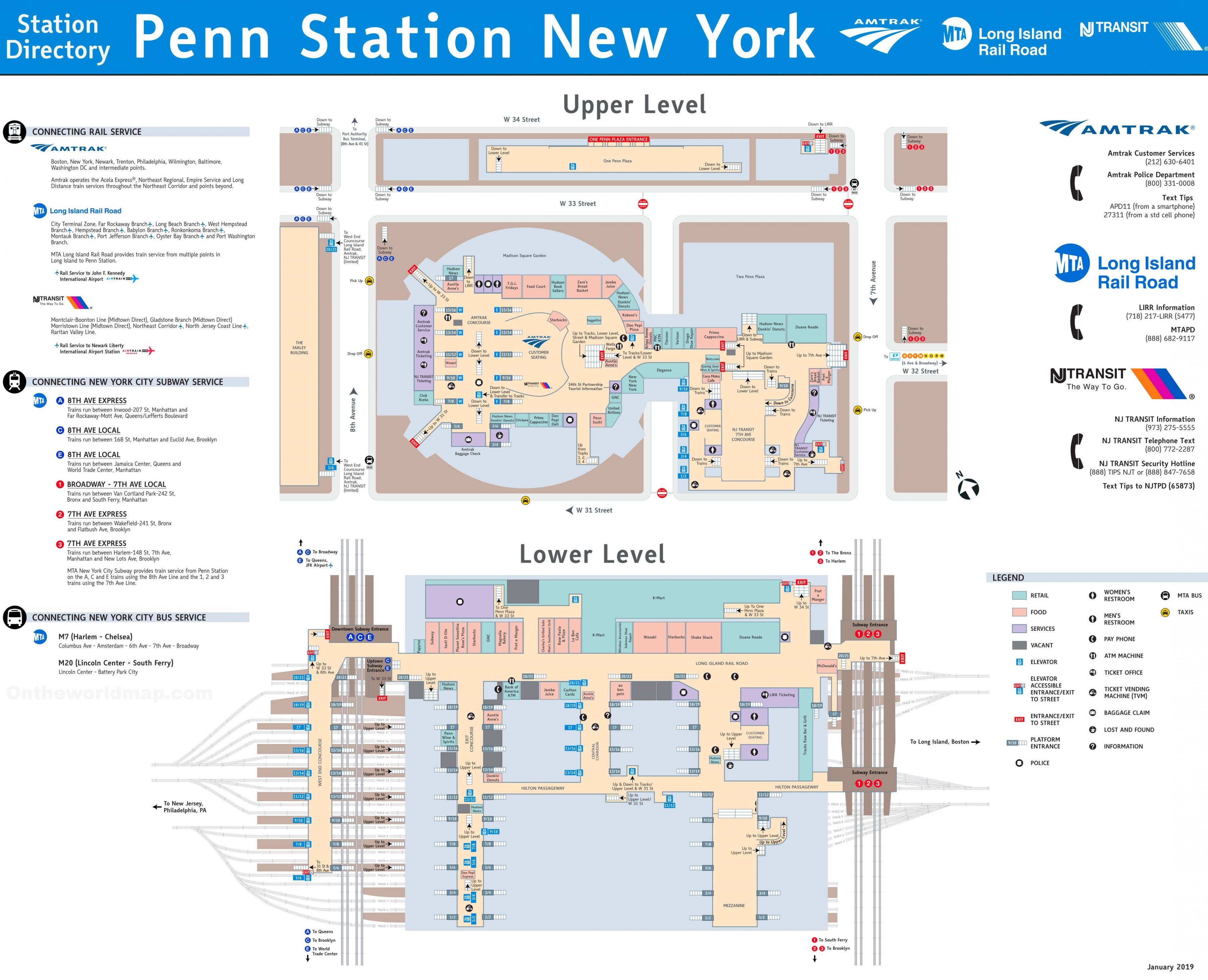
Penn station NYC is serving 300,000 passengers a day (compared to 140,000 across town at Grand Central Terminal) at a rate of up to a thousand every 90 seconds, Penn station NYC is the busiest passenger transportation facility in the United States and by far the busiest train station in North America (as its shown in Penn station NYC map.
Penn Station of NYC is at the center of the Northeast Corridor, an electrified passenger rail line extending south to Washington, D.C., and north to Boston as its mentioned in Penn station NYC map. Intercity trains in Penn station NYC are operated by Amtrak which owns the entire station, while commuter rail services are operated by the Long Island Rail Road and New Jersey Transit.
Penn Station of NYC saw 8.4 million Amtrak passenger arrivals and departures in 2010, about double the traffic at the next busiest station, Union Station in Washington, D.C. Penn Station of NYC assigned IATA airport code is ZYP. Penn station NYC Amtrak and NJ Transit station code is NYP (see Penn station NYC map).