
search
NYC elevation map
New York elevation map. NYC elevation map (New York - USA) to print. NYC elevation map (New York - USA) to download. NYC is not one of the highest or lowest states in terms of average elevation. The mean elevation reading for New York State is 1,000 feet (300 m), so the elevation of New York City is much lower than the state average and the Big Apple is one of the lowest points in the whole state as its shown in NYC elevation map. Other major cities in New York State apart from NYC include the state capital of Albany, which has an average elevation of 64 feet (20 m), Buffalo, which has an elevation of 600 feet (183 m), and Rochester, which has an elevation of 505 feet (154 m), so NYC elevation is generally much lower than these other locations.
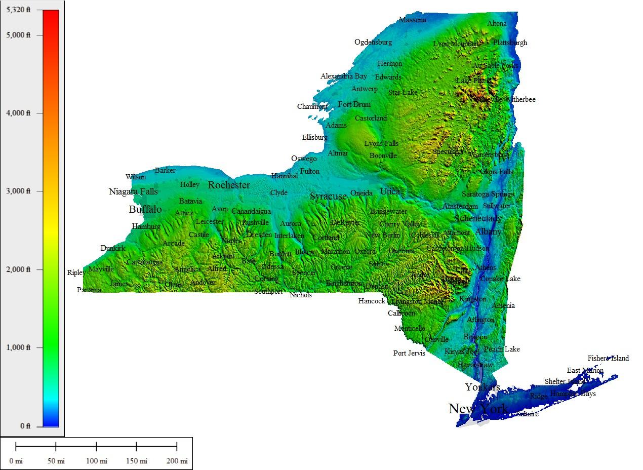
Whenever we talk about the important geographical statistics of a town or city, elevation is always an important reading to consider. The elevation of a location tells us how high or low it is in relation to sea level. Despite having some of the tallest buildings in the world and being well-known for its towers and skyscrapers, NYC has a very low elevation of just 33 feet (10 m) above sea level as its mentioned in NYC elevation map. NYC elevation is so low due to its location right on the coast of the United States.
Many high man-made structures can be found all around NYC, but the highest natural point in the state is Todt Hill. Located on Staten Island, Todt Hill has an elevation of 401 feet (122 m) and is actually the highest elevation point in the Atlantic coastal plain, which extends all the way down to Florida as you can see in NYC elevation map. The highest elevation point in all of New York State is Mount Marcy, a mountain located in Essex County and standing at an elevation of 5,343 feet (1,628.67 m), while the state lowest point is technically the Atlantic Ocean, which is at sea level.