
search
NYC bridges map
New York bridges map. NYC bridges map (New York - USA) to print. NYC bridges map (New York - USA) to download. NYC bridges and multiple waterways are what once made it the center of trade, but in modern times where water transport is less common they make NYC a city of bridges and tunnels. Over 2,000 of them provide uninterrupted vehicular movement throughout the region. Ten bridges and 1 tunnel serving NYC have been awarded some level of landmark status as its shown in NYC bridges map.
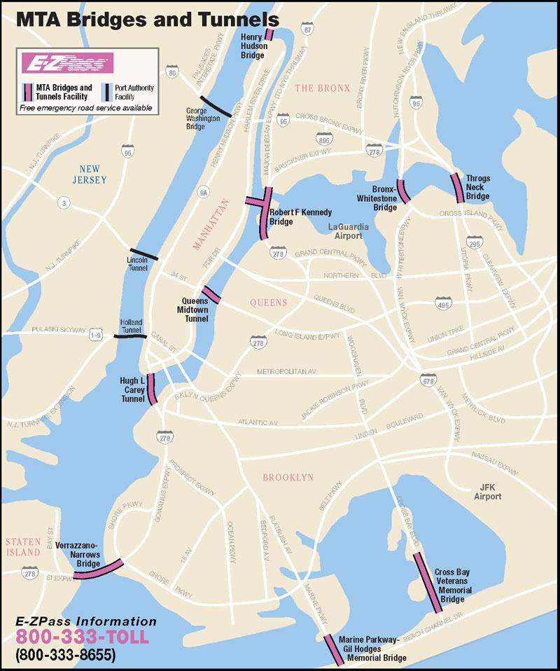
The Brooklyn Bridge, Williamsburg Bridge, George Washington Bridge, and Verrazano-Narrows Bridge were the world longest suspension bridges when opened in 1883, 1903, 1931, and 1964 respectively as its shown in NYC bridges map. NYC crossings date back to 1693, when its first bridge, known as the King Bridge, was constructed over Spuyten Duyvil Creek between Manhattan and the Bronx. The bridge, composed of stone abutments and a timber deck, was demolished in 1917. The oldest crossing still standing is High Bridge which connects Manhattan to the Bronx over the Harlem River. This bridge was built to carry water to NYC as part of the Croton Aqueduct system.
NYC features bridges of all lengths and types, carrying everything from cars, trucks and subway trains to pedestrians and bicycles. The George Washington Bridge, spanning the Hudson River between NYC and Fort Lee, New Jersey, is the world busiest bridge in terms of vehicular traffic. The George Washington Bridge, Verrazano Narrows Bridge and the Brooklyn Bridge as its shown in NYC bridges map are considered among the most beautiful in the world. Others are more well known for their functional importance such as the Williamsburg Bridge which has 2 heavy rail transit tracks, 8 traffic lanes and a pedestrian sidewalk.