search
Downtown NYC map
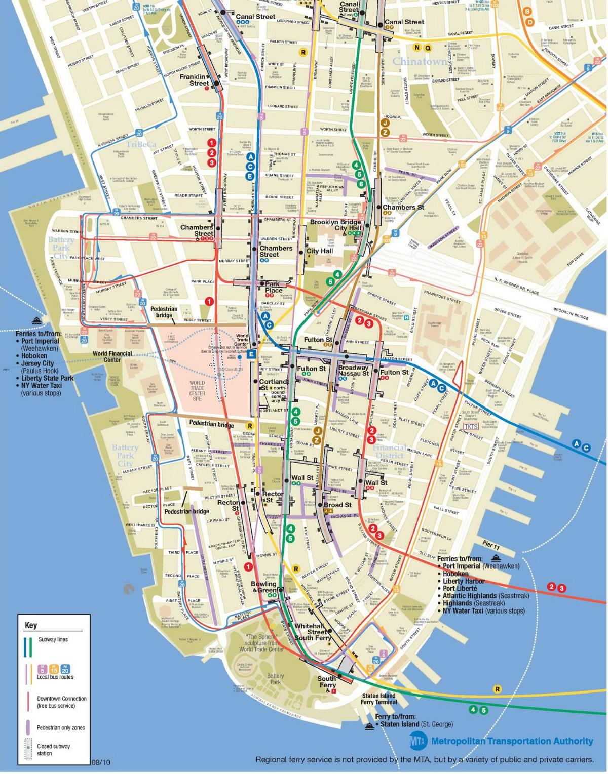
Printable map of downtown New York City. Downtown NYC map (New York - USA) to print. Downtown NYC map (New York - USA) to download. Downtown has two different meanings, which makes things confusing. Downtown NYC can mean a place -- Lower Manhattan -- Wall Street/City Hall and nearby areas, and it is a direction, that is, heading south in Manhattan as its shown in downtown NYC map. So although it sounds funny, you had go downtown NYC from midtown to get to downtown, and you had go downtown NYC from the Upper West Side (or Upper East Side) to get to midtown or downtown.
This is important because this is the way most subway stations and platforms are marked - e.g. Uptown and the Bronx, or Downtown and Brooklyn as its mentioned in downtown NYC map. If you were on the Upper West side and wanted to go to midtown, you had want a platform marked something like Downtown NYC and Brooklyn, even though you weren't going to "Downtown." Unlike most other American cities, "downtown NYC" in Manhattan does not mean "center city."
Lower Manhattan is the southernmost part of the island of Manhattan, the main island and center of business and government of the City of New York. Lower Manhattan or "downtown NYC" is defined most commonly as the area delineated on the north by 14th Street as you can see in downtown NYC map, on the west by the Hudson River, on the east by the East River, and on the south by New York Harbor (also known as Upper New York Bay).


