
search
Path station map
NYC path map. Path station map (New York - USA) to print. Path station map (New York - USA) to download. some path stations are adjacent or connected to New York City Subway, Newark Light Rail, Hudson-Bergen Light Rail, and New Jersey Transit stations as its shown in path station map, there are no free transfers between these different, independently run transit systems; however, path station does accept the same pay-per-ride MetroCard used by the New York City Subway.
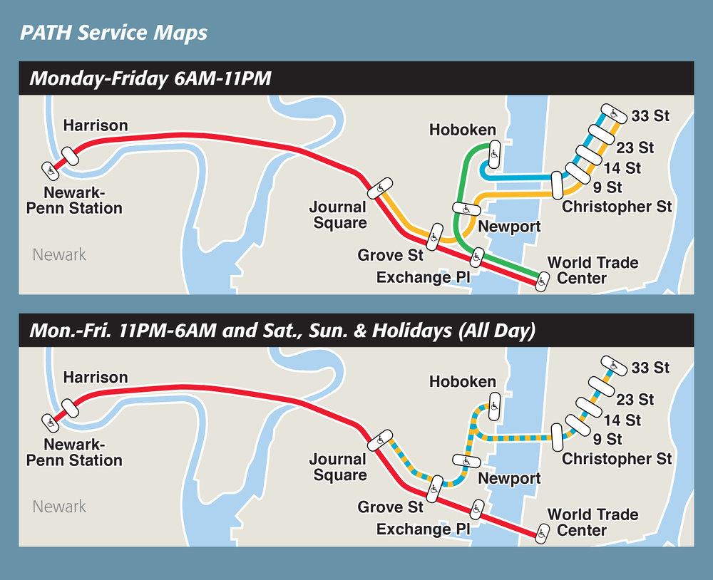
There are currently 13 active path station as you can see in path station map. Path trains and stations have occasionally been the setting for music videos, commercials, and TV programs, sometimes as a stand-in for the New York City Subway. Notable examples are the video for the White Stripes song "The Hardest Button to Button", which was taped at the 33rd Street path station.
The path station map shows a detailed list of stations for path New York. Please also note that path timetables differ according to whether it is a weekend or a weekday. The individual lines are marked in different colors. One of the most popular destinations for locals to live on and for tourists to find a hotel is currently Jersey City. With WTC PATH, it takes only 5 minutes to get to Exchange Place, where many hotels are located. In Jersey City, these are the PATH Train stations.