
search
New York highway map
NYC highway map. New York highway map (New York - USA) to print. New York highway map (New York - USA) to download. To complement New York vast mass transit network, the city also has an extensive web of highways, expressways and parkways, that link New York City to Northern New Jersey, Westchester County, Long Island, and southwest Connecticut through various bridges and tunnels as its shown in New York highway map. Because these highways serve millions of suburban residents who commute into New York, it is quite common for motorists to be stranded for hours in traffic jams that are a daily occurrence, particularly during rush hour.[
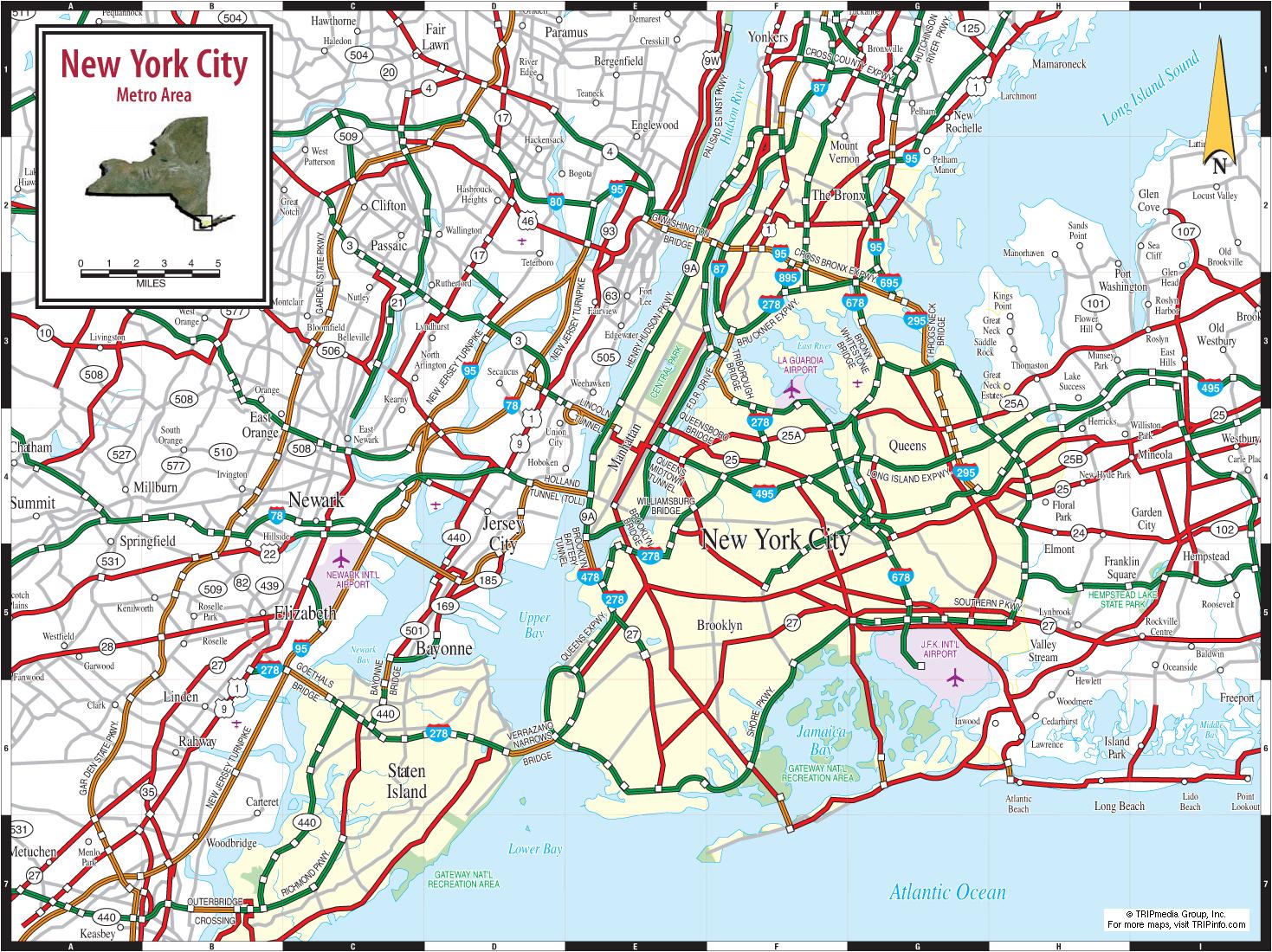
Leaving New York to get to points west via New Jersey, the highway I-78 is the best to use. Emerging from the Holland Tunnel, it feels like a highway version of Midtown Direct NJ Transit service as its mentioned in New York highway map. Clean and easy. The highway I-87 is long and has very distinct parts, some of them very bad, like the part known as the Major Deegan Expressway of New York.
The highway 86/New York State Route 17 is the tri-state area best-kept secret as you can see in New York highway map, a highway that feeds into New York, is not boring to drive, and also happens to be beautiful 95 percent of the time you are driving this highway. On many maps, it does not show up as a proper highway for the last 150 miles or so, before it runs into the New York State Thruway.