
search
NYC bike lane map
NYC cycling map. NYC bike lane map (New York - USA) to print. NYC bike lane map (New York - USA) to download. In the last five years, NYC DOT has expanded and enhanced the on-street bike network by more than 330 miles, including more than 82 protected bike lane miles, with 20 miles installed in 2018 as its shown in NYC bike lane map. NYC DOT installed over 66 lane miles of bike facilities, including 55 bike lane miles of dedicated cycling space in 2018.
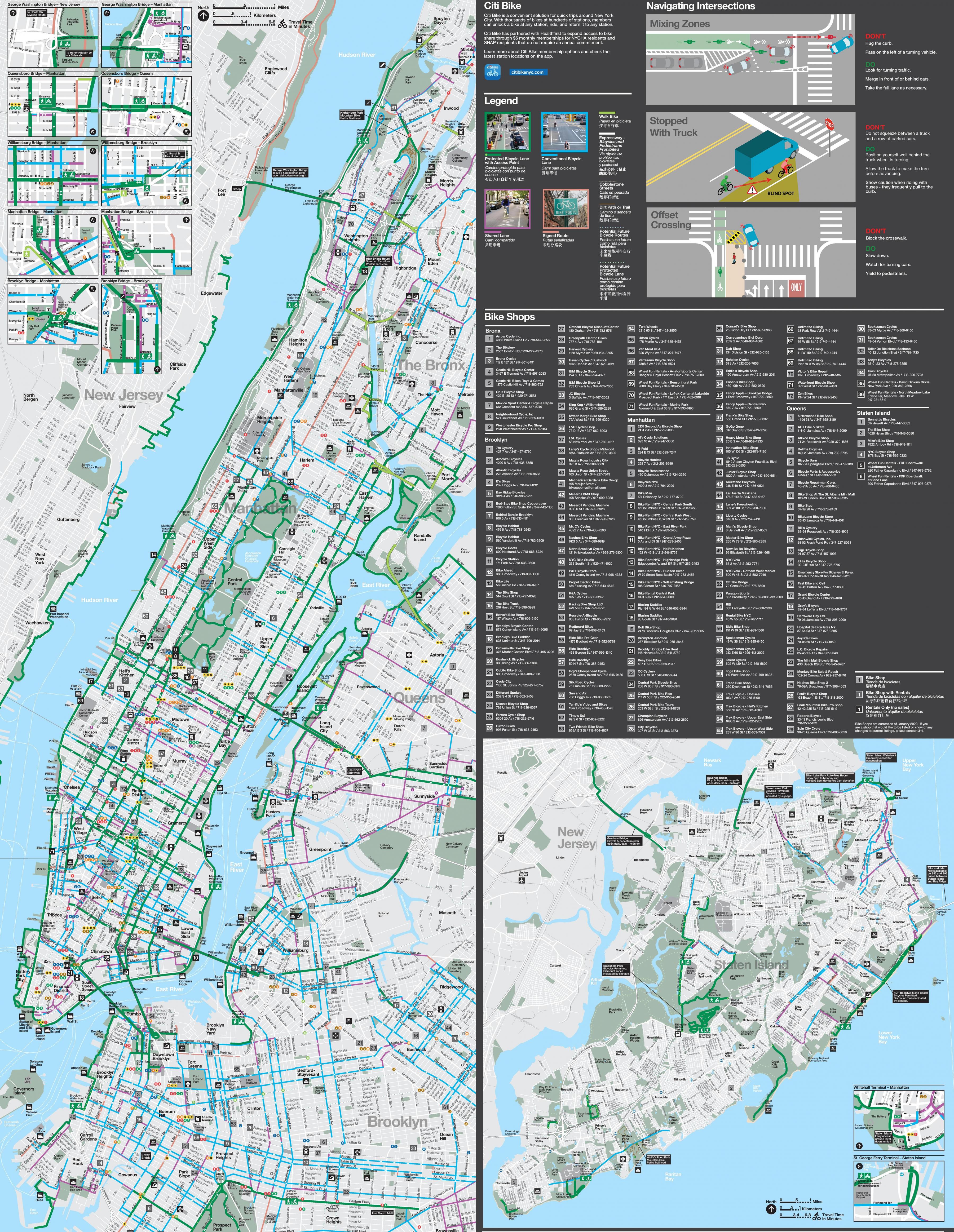
With the expansion of NYC bike lane on City streets, along with the miles of new greenway paths in public parks, and the introduction of bike share, there have never been more people biking in NYK. The creation of local bike lanes beyond the Manhattan Core—in communities such as Jamaica and Bath Beach as its mentioned in NYC bike lane map- encourages people to use a bike to get around their own neighborhoods, run errands, or visit friends.
Miles of protected on-street NYC bike lanes are emboldening the more cautious and risk-averse New Yorkers to take to the streets on a bike, while the expanding reach of CitiBike makes biking increasingly more convenient for quick trips and multimodal commutes in NYC—even for those who do not own a bike (see NYC bike lane map).