
search
J train map
Map of j train. J train map (New York - USA) to print. J train map (New York - USA) to download. The j train Nassau Street Express and Z Nassau Street Express (earlier Jamaica Express) are two rapid transit services of the B Division of the New York City Subway. They are colored brown, since they use the BMT Nassau Street Line in Lower Manhattan. The j train runs at all times, while the Z only operates during rush hours in the peak direction; both services use the entire BMT Archer Avenue Line and BMT Jamaica Line from Jamaica Center – Parsons/Archer over the Williamsburg Bridge to Lower Manhattan as its shown in j train map.
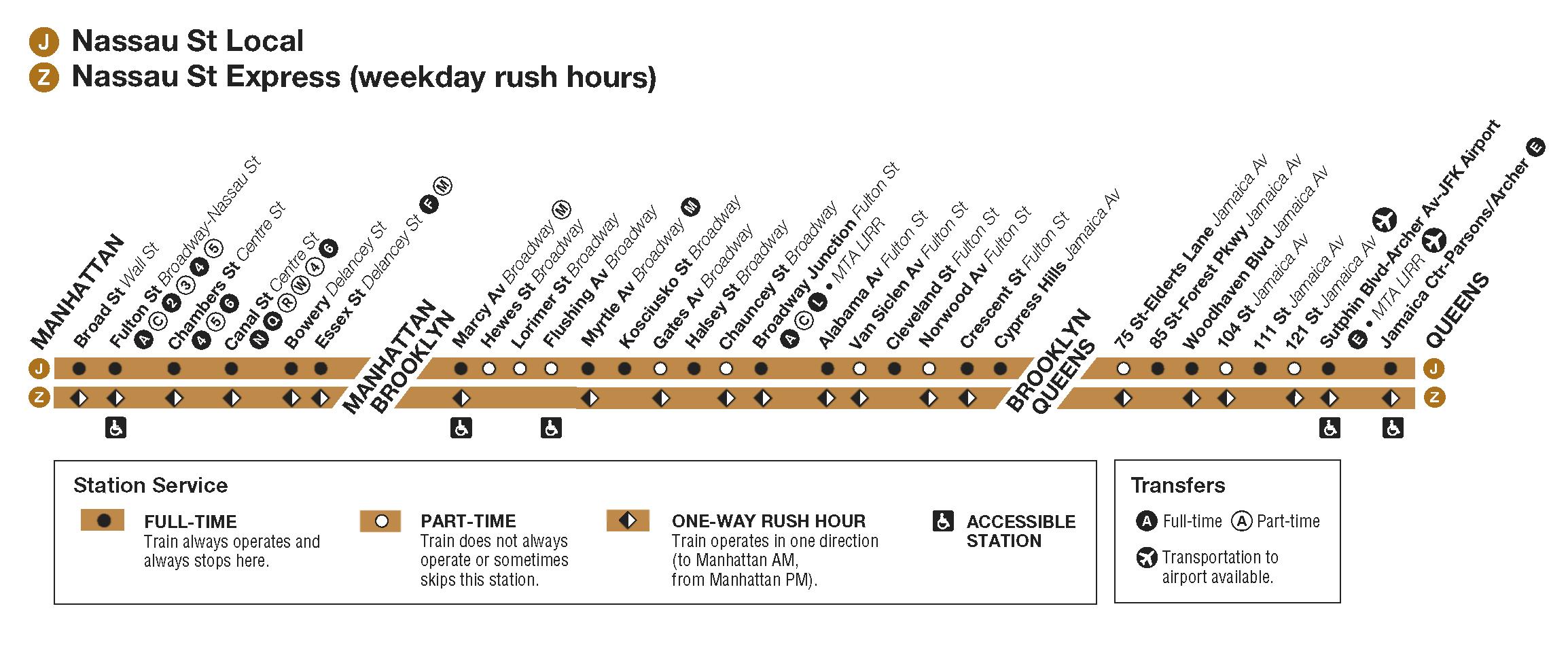
Rush hour service in the peak direction is express west of Myrtle Avenue, and the j train and Z form a skip-stop pair east of Myrtle Avenue. During weekdays, the j train and Z run to the southernmost station on the Nassau Street Line, Broad Street, but the j train is cut back on weekends to Chambers Street. Broad Street and Fulton Street are thus the only two stations that are not served full-time as its mentioned in j train map. Until 1976, the Jamaica Line (over Broadway west of East New York) was also served by the KK Broadway Brooklyn Local (K after 1973), which ran to 57th Street via the Chrystie Street Connection after 1968. This was the successor to the original BMT Canarsie Line service, which ran full-time until the 14th Street–Eastern Line was completed to East New York in 1928.
The Jamaica Line or j train then known as the Broadway Elevated - was one of the original elevated lines in Brooklyn, completed in 1893 from Cypress Hills west to Broadway Ferry in Williamsburg. The j train was then a two-track line, with a single local service between the two ends, and a second east of Gates Avenue, where the Lexington Avenue Elevated merged (see j train map). This second service of j train later became the 12, and was eliminated in 1950 with the abandonment of the Lexington Avenue el.