
search
Old NYC subway map
Old New York subway map. Old NYC subway map (New York - USA) to print. Old NYC subway map (New York - USA) to download. Construction of NYC first old subway line began with a contract between the Rapid Transit Construction Company and NYC on Feb. 21, 1900 (see old NYC subway map). The contract, worth $35 million and built upon a winning bid by John B. McDonald and financing by August Belmont, gave the Rapid Transit Construction Company, later called the Interborough Rapid Transit Company, the right to all tracks they built and a 50-year operating lease.
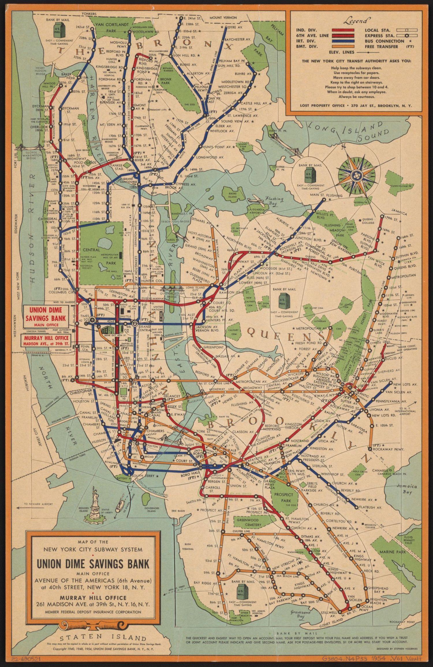
The completed first old NYC subway line opened on Oct. 27, 1904, to the immense excitement of the public, 150,000 of whom would ride it by the end of the day. The old NYC subway ran a total of 9.1 miles from City Hall in lower Manhattan to 145th Street and Broadway in Harlem, and it featured 28 stops, including Times Square and Grand Central Terminal as its shown in old NYC subway map. At 2:35 p.m., Mayor George McClellan controlled the first train, filled with contractors, investors, and employees of the Interborough Rapid Transit Company.
In the early 1950s, things began to change for the old NYC subway commuters. The five-cent rates that had existed for over three decades rose to ten cents in 1948 and again to 15 cents in 1953. Due to the turnstiles inability to handle two different-sized coins, the rise in fares coincided with the introduction of subway tokens. While a few expansion projects of the old NYC subway were completed at this time, such as the lines from Rockaway Park to Wavecrest and the Bronx to Coney Island (as its mentioned in the old NYC subway map), the old NYC subway system focused more on maintenance and paying off the lines built in the late 1930s during this period.