search
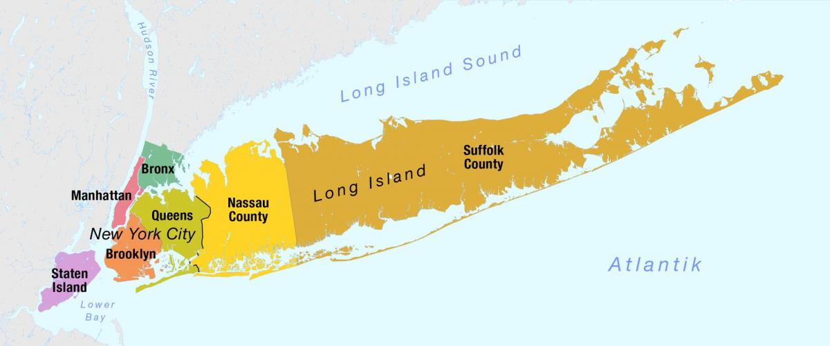
Map of New York City and long island
Map of New York City including long island. Map of New York City and long island (New York - USA) to print. Map of New York City and long island (New York - USA) to download. The westernmost end of Long Island contains the New York City boroughs of Brooklyn (Kings County) and Queens (Queens County) as its shown in the map of New York City and long island. The central and eastern portions of long island contain the suburban Nassau and Suffolk counties. However, colloquial usage of the term "Long Island" refers only to Nassau and Suffolk counties. The more dense and urban Brooklyn and Queens are not usually referred to as "Long Island", since they are a part of New York City, though before those counties amalgamated into the city, they were often so identified.
Long Island is geographically part of the Mid-Atlantic, however many towns and hamlets along the island north shore as its mentioned in the map of New York City and long island, in western Nassau County and in eastern Suffolk County, such as Oyster Bay, Port Jefferson and Sag Harbor seem to resemble New England towns, while many of the towns of New York City and hamlets along the south shore, such as Long Beach, Valley Stream, and Babylon seem to resemble Mid-Atlantic coastal communities, especially those on the shore between New Jersey and Virginia. Many of the towns in Long Island central region resemble typical suburban towns, with strip malls, traffic-clogged avenues and fast-food restaurants.
Long Island, island in the Atlantic Ocean that comprises the southeasternmost part of New York state, U.S. as its shown in the map of New York City and long island. Long island lies roughly parallel to the southern shore of Connecticut, from which it is separated to the north by Long Island Sound. Long Island western end forms part of the harbour of New York City. Long island has four counties; from west to east they are Kings, Queens, Nassau, and Suffolk.


