search
F train map
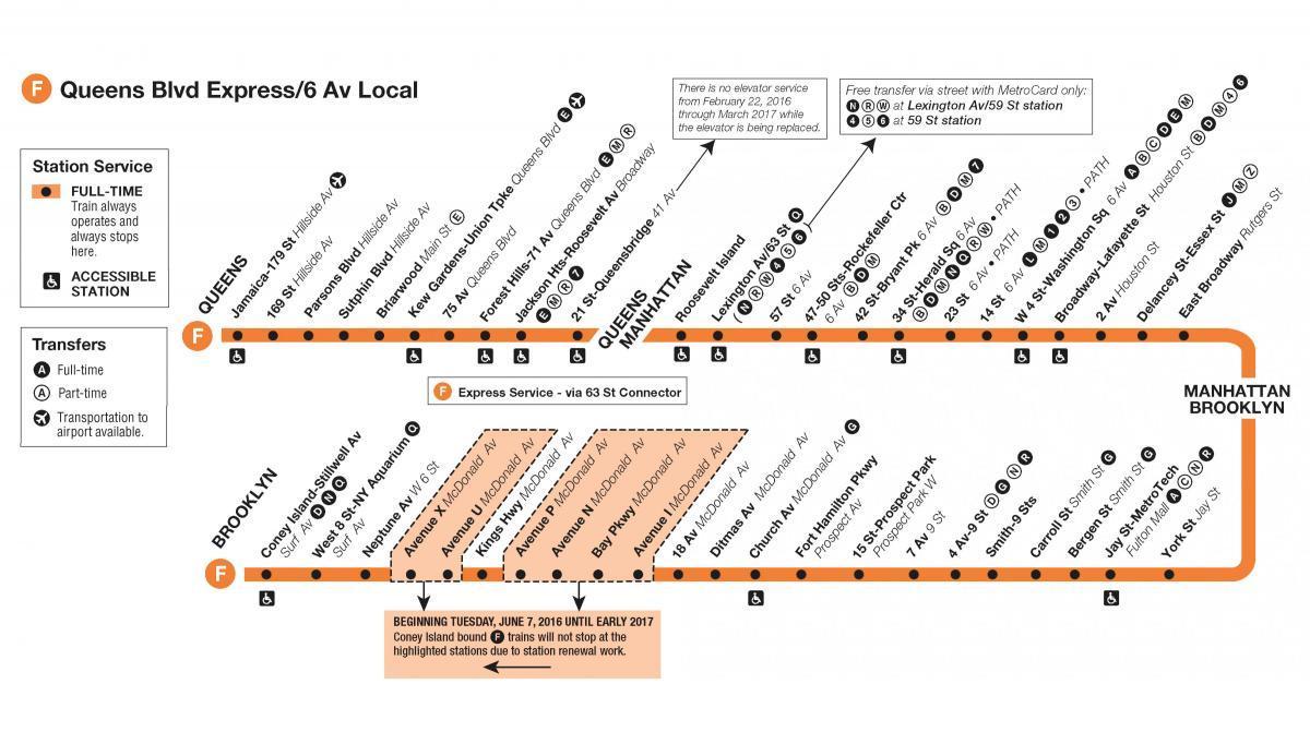
F train map New York. F train map (New York - USA) to print. F train map (New York - USA) to download. The f train Sixth Avenue Local is a rapid transit service of the New York City Subway. The f train is colored bright orange on route signs, station signs, and the official subway map, since it runs on the IND Sixth Avenue Line through Manhattan as its shown in f train map. Peak-direction express service on the f train in Brooklyn began on Monday, Sept. 16, 2019. Express service of f train runs between Church Av and Jay St-MetroTech, making one stop at 7 Av. F Express riders can save up to 7 minutes during their morning commute, and up to 6 minutes on their afternoon ride home.
The f train service operates at all times between 179th Street in Jamaica, Queens and Stillwell Avenue in Coney Island, Brooklyn via Queens Boulevard in Queens, 63rd Street and Sixth Avenue in Manhattan, and Culver in Brooklyn, making all stops except for an express section in Queens between Forest Hills – 71st Avenue and 21st Street – Queensbridge as its mentioned in f train map. Since Coney Island - Stillwell Avenue cannot handle the large number of f trains during rush hour, select trains short-turn at Kings Highway.
Two diamond-designated f trains depart Jamaica-179 St in time to leave Midtown during the heart of PM rush as you can see in f train map. Those two f trains make all regular stops along the line to Jay St-MetroTech. From Jay St-MetroTech to Church Av, f trains run express, making only one stop at 7 Av. From Church Av to Coney Island-Stillwell Av, trains resume making all local stops.
Two diamond-designated f trains depart Coney Island-Stillwell Av during the AM rush as its mentioned in f train map. These f trains make all local stops between Coney Island-Stillwell Av and Church Av. From Church Av to Jay St-MetroTech, trains run express, making only one stop at 7 Av. From Jay St-MetroTech through to Jamaica-179 St, trains resume regular service, making all regular f train stops.


